


This 113-acre preserve, our largest fee-owned property, protects habitat for bobcat, black bear, spotted salamanders and many more creatures, while providing an important link to the Appalachian Trail. This preserve is the result of a successful partnership with Simpson Development, who agreed to cluster the Silent Brook and Velvet Rocks developments in order to protect the remaining 113 acres as a natural area. The Town of Hanover was instrumental in this land’s protection in 2008 and holds the conservation easement.
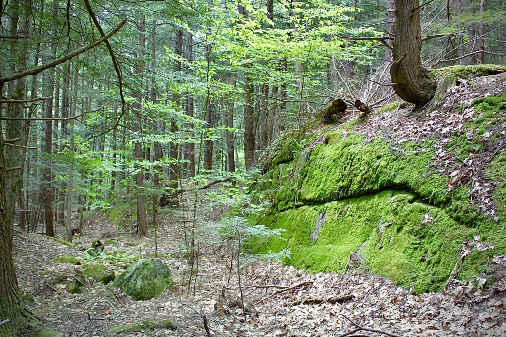
Greensboro Ridge offers a natural retreat just east of downtown Hanover, off Greensboro Road. The predominant natural community is upland forest composed of white pine and hemlock. Small intermittent streams cross the property, and tucked-away vernal pools are a delight to explore in the spring months. The trail traverses a breathtaking landscape as it climbs up the ridge and connects with the Appalachian Trail near Velvet Rocks. Visitors will remark on the preserve’s ferny clearings, woodland streams, mossy glens, and dramatic rock ledges. Bikes are allowed only on the Silent Brook Trail, and hunting for white-tailed deer is allowed north of this trail.
How to get there
Oli’s Eagle Trail & Silent Brook Trail: From Greensboro Road, turn onto Velvet Rocks Drive and continue to the trailhead parking area at the top of the road. The Silent Brook Trail can also be reached from the Silent Brook housing development. From Greensboro Road, turn onto Silent Brook Drive, turn right, and park beyond the homes’ parking area. The trail begins at the upper northeast corner of the development. Please respect the privacy and property of the Velvet Rocks and Silent Brook communities on your way to and from the Natural Area. No overnight parking is permitted at the trailhead area.
The 0.6 mile Greensboro Highlands Trail, on a route recommended by biologists to showcase the property’s fascinating natural features while avoiding sensitive habitats, links existing trails to create a new loop past dramatic rock faces and more. Vertical gain is about 300 feet. The trail is for foot travel only. Oli’s Eagle Trail (0.5 miles, foot travel only), connects to the Appalachian Trail in a 20 minute hike, traversing easy to moderate terrain. Sections of the trail pass over rocks and boulders, so sturdy footwear is recommended. The 0.4 mile Silent Brook Trail, where mountain biking is also permitted, connects the Silent Brook and Velvet Rocks neighborhoods. Generous donors, including the Hypertherm HOPE Foundation, pitched in with the funds needed to make this trail a reality.
Trailhead Kiosk
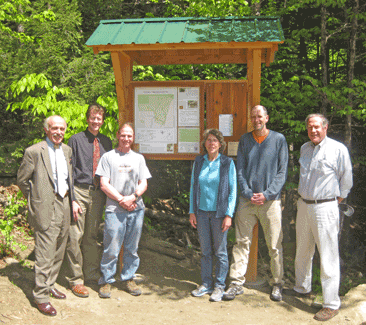
Many thanks to Trumbull-Nelson for the beautiful kiosk greeting hikers at the beginning of Oli’s Eagle Trail at the top of Velvet Rocks Drive. The Town of Hanover DPW crew installed the footings. Posted here are an updated trail map, tidbits about the Natural Area’s wildlife and special habitats, trail details, and guidelines for use. Watch this space for special notices about happenings at the Natural Area.
Geology
Thanks to Carl Renshaw, Professor of Earth Sciences at Dartmouth College and a former Board member, for compiling this history!
Geologically, Greensboro Ridge is part of the Lebanon Dome, one of a series of granitic
domes that form many of the hilltops along the eastern edge of the Connecticut River.
Geologically similar nearby domes include the Mascoma Dome that forms Holt’s Ledge and
the Smarts Mountain Dome which forms the mountain of the same name. These domes,
along with others that extend through western New Hampshire and central Massachusetts
to Long Island Sound, are collectively known as the Oliverian Domes.
It is thought that the Lebanon, Mascoma, and Smarts Mountains domes may be connected
at depth and likely were part of the magma chamber that fed the Ammonoosuc volcanoes.
During Ordovician times (about 460 million years ago) the area that is now Greensboro
Ridge was similar to the modern arc of volcanic islands of Indonesia. In Indonesia, the
island arc is the surface manifestation of the subduction of the northbound Australian Plate
beneath the Eurasian Plate. During Ordovician times, the Ammonoosuc volcanoes and their
granitic magma chambers were the surface manifestation of the subduction of the floor of
the ancestral Atlantic Ocean. The Oliverian Domes are thought to represent the magma
chambers of an arc of island volcanoes, the Bronson Hill Complex, created during the first
episode of Appalachian mountain building, or the Taconic Orogeny.
In the center of the Lebanon Dome is Lebanon granite that forms the highest parts of the
Greensboro Ridge Natural Area. Encircling the granite is Lebanon border gneiss, granite
that has been secondarily compressed and has developed a banded texture. The foliated
(i.e., banded) border gneiss is visible at the lower elevations of the ridge. The Lebanon
granite is pinkish in fresh exposure owing to its rich content of potassium feldspar, named
orthoclase. The characteristic hue fades in the weathered surfaces of the rocks as the
feldspar weathers to kaolinite, a white, chalky clay.
While the rocks of Greensboro Ridge are quite old, their present topography is much more
recent and reflects the effects of the recurring ice sheets that covered the region during the
last two million years. As the ice sheets advanced southward, they ground smoothly over
the upstream, north-facing slopes of hills. But along south-facing ridges, such as
Greensboro Ridge, rocks were subjected to slow but inexorable pulling and plucking,
leaving a ragged and relatively steep surface.
This preserve is the result of a successful partnership with Simpson Development, who agreed to cluster the Silent Brook and Velvet Rocks developments in order to protect the remaining 113 acres as a natural area. The Town of Hanover was instrumental in this land’s protection in 2008 and holds the conservation easement.
Enjoy two geocaches at Greensboro Ridge:
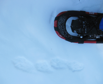

Research for our natural resources inventory of Greensboro Ridge in 2011 revealed much winter wildlife activity. Fisher are using the protected property, ranging across the ridge and over stream courses in their solitary, nocturnal hunt for food.
The fisher (Martes pennanti), sometimes erroneously called a “fisher cat,” seldom eats fish, nor is it a cat. Its closest relative is the pine marten; cousins include mink, otter, and weasels. The lithe brown creatures were once common throughout New England, but declined due to over-trapping, logging, and habitat loss. Trapping regulations and natural reforestation of abandoned farms enabled the fisher to rebound throughout New Hampshire.
Fisher are solitary except during the mating season. Mating occurs in March and April with a litter of 1-6 (average 3) kits born nearly a year later. Females usually give birth in a tree cavity 20-30 feet off the ground.
Fisher regularly travel 10-20 miles in search of food, moving along ridges and crossing stream valleys. Secretive and nocturnal, the fisher is a skilled predator that plays an important role in regulating populations of smaller mammals. The only predator adapted for taking down porcupines, the fisher has a stomach capable of softening up the defensive spines. The fisher is known for launching sneak attacks from high above its unsuspecting dinner. Its ankle joints can rotate 180 degrees, allowing the animal to climb both up and headlong down a tree.
Additional animals seen, heard or reported by neighbors include black bear, bobcat, red fox, coyote, white-tailed deer and many bird species. Barred owls are frequently heard here with their familiar “Who cooks, who cooks for you” call.
The majority of Greensboro Ridge is forested and largely made of large hemlock stands. Walk these trails in the summer, and you’ll appreciate the enormous cooling effect a hemlock forest has! A few fern-covered openings are scattered throughout as a reminder of the home sites that were cleared before this area was conserved. We keep these open to provide additional habitat to birds and small mammals, and work to maintain berry brambles and more productive plants in these clearings.
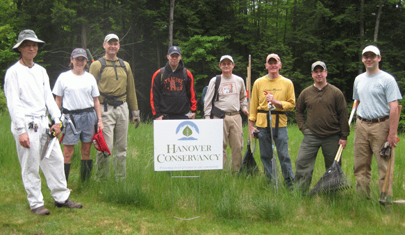
We rely heavily on volunteers to maintain our properties- both individuals and corporate groups, like the crew from Hypertherm pictured above. Whether clearing trees, building bog bridges or blazing trails, volunteers are an essential part of achieving our mission!
Related Articles
| Announcing Spring Trips! | March 29, 2023 |
| Sunsquatch StoryWalk at Greensboro Ridge | October 4, 2022 |
| Greensboro Ridge 10th Anniversary today! | October 3, 2018 |
