


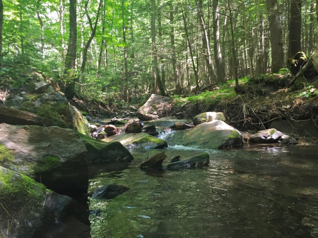
The 38-acre Jim and Evalyn Hornig Natural Area at Lower Slade Brook offers a quiet retreat with easy walking terrain next to Slade Brook. From Hanover Center to its confluence with the Connecticut River, Slade Brook’s banks are undeveloped and graced by convenient hiking trails through varied forestland. The Conservancy’s protection of this property ensures that Lower Slade Brook will always be a pristine environment for people to enjoy and where the native flora and fauna can flourish. The Upper Valley Land Trust holds a conservation easement on the Hanover Conservancy’s property here, and the Conservancy holds easements on the abutting sections of nearby landowners’ properties.
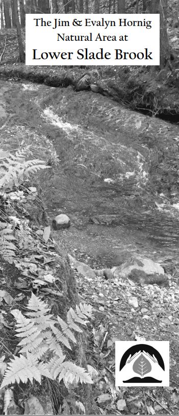
Lower Slade Brook Guide
Lower Slade Brook Map
Slade Brook Watershed Trail Map
Geocaches
How to get there
Take River Road north from Route 10. The property is on the right in 0.6 miles. Limited seasonal parking is available at the River Road trailhead, but it is not plowed in winter. Please do not disturb our neighbors by attempting to park in their driveways.
The main foot path through the Natural Area is the 0.5 mile Waterfall Trail on the north side of Slade Brook. The trail leaves the small trailhead parking area off River Road and follows an old woods road before climbing through the brook’s little valley, offering beautiful views of the falling waters, which are spectacular during high water. Sit and relax on a brand new bench, built by volunteers in 2017! Beyond the last of the three falls, the trail heads away from the brook and up to a plateau. After a right turn just beyond the boundary, the 0.25 mile Lyme Road Connector Trail brings you to Route 10.
A short (0.15 mile) side trail just above the third falls (no bridge) leads to the Purling Brooks neighborhood. The public is welcome to use this trail as far as the Natural Area boundary, but may not continue across private land. Connections to other trails in the area are not currently maintained.
- Slade Brook and its trails are open for foot travel at all seasons.
- Please leave wildflowers, mushrooms, and other growth in place.
- No fires or camping.
- Hunting for white-tailed deer is allowed; trapping and hunting for other species are not permitted. Catch & release fishing is preferred.
- Please leave no trace of your visit.
- Please pick up after your pet and remove the waste. Dogs must be under the direct control of their owners (i.e. leash, e-collar or effective voice control) and not chase wildlife.
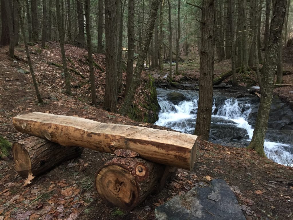
This lovely rustic bench was created by volunteers after several large trees fell far downstream, blocking the trail. It’s the perfect spot to sit and enjoy Lower Slade’s largest cascade.
Enjoy this wonderful video of the lovely Hornig Natural Area, created by Conservancy intern Morgan Danna:
A Conservation Development Success Story
When a developer presented a plan for 17 houses in this area, the Conservancy (then known as the Hanover Conservation Council) proposed an alternative that resulted in 10 homes clustered on 20 acres on the south side of the brook, on the site of a former gravel pit, and the rest of the property left intact. This solution protected the brook and its undisturbed valley, while providing recreational trails for homeowners in the Purling Brooks neighborhood and the wider community. Jim Hornig, former president of the Council, was the inspiring force behind the creation of this preserve in 2005, and the Council gratefully named the Natural Area in honor of Jim and his wife, Evalyn.
The Slade Brook Valley
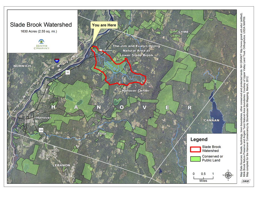
Slade Brook is 4.0 miles long and drains a largely forested 1630-acre watershed. Nearly a third of this watershed is protected, including the Lower Slade Brook Natural Area, Huntington Hill Wildlife Management Area, and three other conserved parcels.
Glacial Lake Hitchcock
Fifteen thousand years ago, the Lower Slade Brook Natural Area was submerged in the frigid waters of melting glaciers that created Lake Hitchcock. The steep slopes surrounding you formed as Slade Brook sliced through the lake-bottom sediments left behind when the lake drained 12,000 years ago and the Connecticut River took its place. When you reach the junction of the Waterfall Trail and the Lyme Road Connector Trail, you are standing at nearly the same elevation as the bottom of Lake Hitchcock. Modest Slade Brook demonstrates the power of moving water to sculpt away 100 feet of sediment down to the bedrock exposed at its flumes and falls. You can explore similar formations at the Rinker-Steele Natural Area two miles south of here, where Camp Brook also created such changes in its lower watershed.
Explore this protected area with the Lower Slade Brook Quest, designed by Vital Communities.
Can you find the Lower Slade Brook Geo-cache?
The Lower Slade Brook Natural Area has been forested for at least the last 100 years, and now hosts many kinds of wildlife, including fisher, deer, fox, and coyote. Black bear and moose follow Slade Brook in their travels between Moose Mountain and the Connecticut River.
Biologists have found 232 species of plants and three primary plant community types here. The hardwood forest seep on the river terrace slope occurs in small patches along the stream, surrounded on drier land by hemlock-beech-oak-pine forest. Farther above the stream is a hemlock-beech-northern hardwoods forest.

The Slade Brook forest, close to the Connecticut River, is a rich migratory stop-over and feeding site for birds traveling up the river valley in spring, and also for resident nesting birds. Thirty-five species of birds have been documented here. Among them is the Louisiana Waterthrush, an uncommon bird that requires forested habitats with open streams. Listen for its musical song, a series of descending notes ending in a warble.
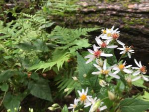
Slade Brook is forested, with white pines and eastern hemlocks keeping the trail shady and cool year-round. Where trees have blown down in storms, small openings of ferns and wildflowers crop up. Much of the land around the Waterfall Trail is in the floodplain, and is regularly scoured by flooding events. Luckily, invasive plants are relatively rare here- we hope it stays that way!
The Conservancy holds easements on the abutting sections of nearby landowners’ properties, which are monitored annually. Much of the work at this preserve is done by volunteers, including signage and clearing downed trees. Occasional projects like adding gravel to the parking area help prevent erosion and improve ease of access for all.
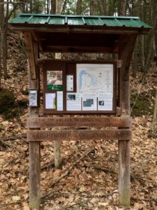
Past vandalism to the kiosk and to dozens of trees in the Natural Area was cause for alarm, but is (thankfully) uncommon. Please contact us with any concerns about this beautiful property!
Related Articles
| Mink Brook log crossing repair | April 17, 2023 |
| Mink Brook Log Crossing Update | August 1, 2022 |
| Mink Brook & Tanzi Tract | September 10, 2021 |

Enjoy on your own:
Explore this protected area with the Lower Slade Brook Quest, designed by Vital Communities.
Can you find the Lower Slade Brook Geo-cache?
A Conservation Development Success Story
When a developer presented a plan for 17 houses in this area, the Conservancy (then known as the Hanover Conservation Council) proposed an alternative that resulted in 10 homes clustered on 20 acres on the south side of the brook, on the site of a former gravel pit, and the rest of the property left intact. This solution protected the brook and its undisturbed valley, while providing recreational trails for homeowners in the Purling Brooks neighborhood and the wider community. Jim Hornig, former president of the Council, was the inspiring force behind the creation of this preserve in 2005, and the Council gratefully named the Natural Area in honor of Jim and his wife, Evalyn.
Enjoy this wonderful video of the lovely Hornig Natural Area, created by Conservancy intern Morgan Danna:
Wildlife

The Lower Slade Brook Natural Area has been forested for at least the last 100 years, and now hosts many kinds of wildlife, including fisher, deer, fox, and coyote. Black bear and moose follow Slade Brook in their travels between Moose Mountain and the Connecticut River.
Biologists have found 232 species of plants and three primary plant community types here. The hardwood forest seep on the river terrace slope occurs in small patches along the stream, surrounded on drier land by hemlock-beech-oak-pine forest. Farther above the stream is a hemlock-beech-northern hardwoods forest.
The Slade Brook forest, close to the Connecticut River, is a rich migratory stop-over and feeding site for birds traveling up the river valley in spring, and also for resident nesting birds. Thirty-five species of birds have been documented here. Among them is the Louisiana Waterthrush, an uncommon bird that requires forested habitats with open streams. Listen for its musical song, a series of descending notes ending in a warble.
The Slade Brook Valley
Slade Brook is 4.0 miles long and drains a largely forested 1630-acre watershed. Nearly a third of this watershed is protected, including the Lower Slade Brook Natural Area, Huntington Hill Wildlife Management Area, and three other conserved parcels.
Glacial Lake Hitchcock
Fifteen thousand years ago, the Lower Slade Brook Natural Area was submerged in the frigid waters of melting glaciers that created Lake Hitchcock. The steep slopes surrounding you formed as Slade Brook sliced through the lake-bottom sediments left behind when the lake drained 12,000 years ago and the Connecticut River took its place. When you reach the junction of the Waterfall Trail and the Lyme Road Connector Trail, you are standing at nearly the same elevation as the bottom of Lake Hitchcock. Modest Slade Brook demonstrates the power of moving water to sculpt away 100 feet of sediment down to the bedrock exposed at its flumes and falls. You can explore similar formations at the Rinker-Steele Natural Area two miles south of here, where Camp Brook also created such changes in its lower watershed.
